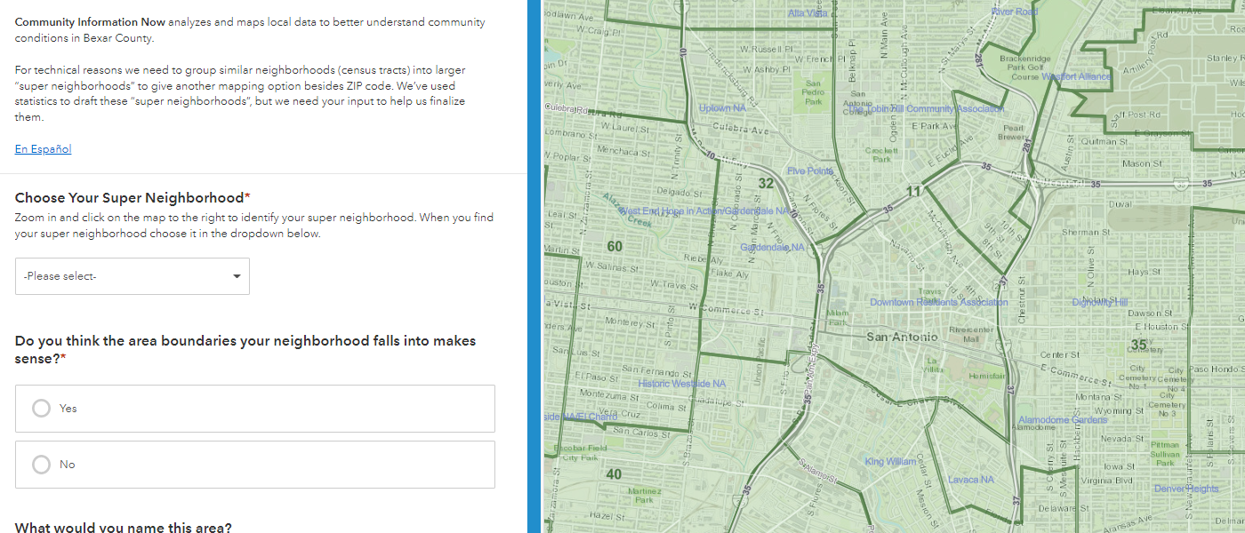
CI:Now is working to develop a new kind of geographic lens for Bexar County. These “super-neighborhoods” are groups of census tracts clustered using statistical methods that factor in poverty, housing, and transportation. Our intent is to create a way to break data down below the county level, but with the areas being large and populous enough that we don’t end up with very small numbers that risk privacy or yield wide margins of error. We’re used to looking at ZCTAs – ZIP code tabulation areas – but those are built for mail delivery. They’re pretty meaningless in social, cultural, economic, and geopolitical terms.
We’ve drafted boundaries for 75 super-neighborhoods, but now we need the input of the people who live there. Please visit this map, look up your super-neighborhood, and tell us if you think the boundaries make sense. Is your neighborhood grouped with other neighborhoods that are more like yours than not? If you disagree, tell us what you think the boundaries should be, or draw them on a map.